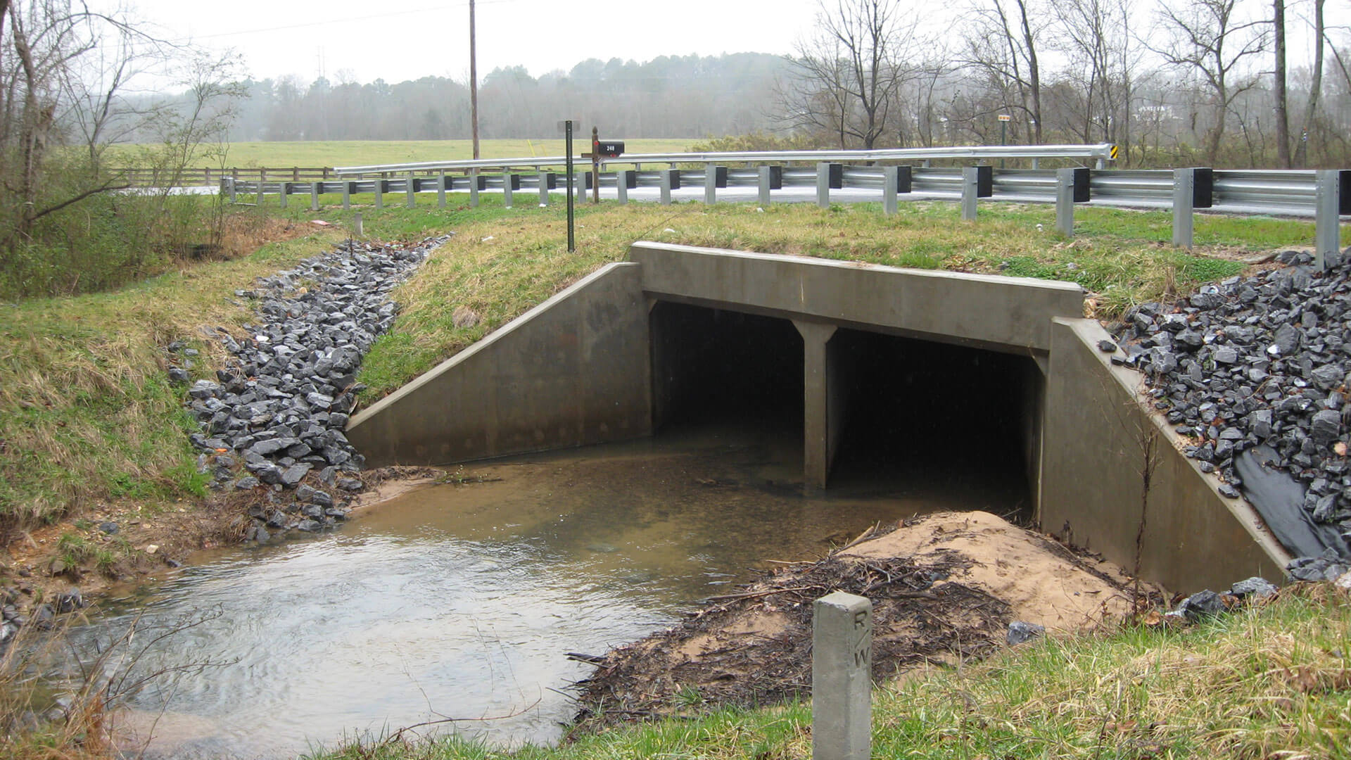
Located 4.5 miles southwest of the City of Dalton and crosses Hurricane Creek
Hurricane Road is a rural two-lane roadway with deficient horizontal geometry and is priority number 24 on the Whitfield County SPLOST Projects Priority List. This project is located approximately 4.5 miles southwest of the City of Dalton and crosses Hurricane Creek. The proposed roadway improvements include improving the horizontal curvature by the realignment of […]Hurricane Road Improvements
Whitfield County, GA
Client
Whitfield County
Completed
Design Plans Completed 2010
Located 4.5 miles southwest of the City of Dalton and crosses Hurricane Creek
Hurricane Road is a rural two-lane roadway with deficient horizontal geometry and is priority number 24 on the Whitfield County SPLOST Projects Priority List. This project is located approximately 4.5 miles southwest of the City of Dalton and crosses Hurricane Creek. The proposed roadway improvements include improving the horizontal curvature by the realignment of the horizontal curve east of the Hurricane Road/Ruth Street intersection and will require the replacement of the a steel beam bridge with double 72-inch by 60-inch corrugated metal pipes extensions at Hurricane Creek. The design of a 100-foot double barrel 10-foot by 7-foot concrete box culvert and cast-in-place cantilever retaining wall was completed as well. Environmental tasks include wetland delineation, wildlife surveys, vegetation surveys, floodplain compensation, and research on potential contamination and cultural resources. In addition, permits were required through the U.S. Army Corps of Engineers, and GDNR, Environmental Protection Division.